


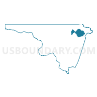
Voting District PENDLE, Northampton County, North Carolina
About
Outline

Summary
| Unique Area Identifier | 641016 |
| Name | Voting District PENDLE |
| County | Northampton County |
| State | North Carolina |
| Area (square miles) | 15.25 |
| Land Area (square miles) | 15.08 |
| Water Area (square miles) | 0.17 |
| % of Land Area | 98.90 |
| % of Water Area | 1.10 |
| Latitude of the Internal Point | 36.49019480 |
| Longtitude of the Internal Point | -77.18826640 |
Maps


Graphs
Select a template below for downloading or customizing gragh for Voting District PENDLE, Northampton County, North Carolina


Neighbors
Neighoring Voting District (by Name) Neighboring Voting District on the Map
- Voting District CONWAY, Northampton County, NC
- Voting District GALATI, Northampton County, NC
- Voting District NEWTOW, Northampton County, NC
- Voting District SEVERN, Northampton County, NC